


Introduction
Adopted December 18, 2003
City of Yreka
701 Fourth Street
Yreka, California 96097
i. Purpose
Section titled “i. Purpose”Imagine that your role is to both know the expectations of City residents and explain them to people new to the community. How would you begin to organize current issues, or estimate future needs? One method is to divide issues into separate areas and write down basic “goals” with explanations. Once completed, the document would be reviewed by the community as a whole and “adopted” as the plan for the City. The document would be used daily by staff in recommending changes to the City and periodically reviewed. Although greatly simplified, the above explains both what the General Plan is, and how it is used.
The General Plan is referred to often by City officials, and by prospective developers. The document both explains what the community expects from new development, and where the development should occur. Goals in the General Plan help the Council in seeking grants and moving the community forward.
i.1. Physical Description & Location
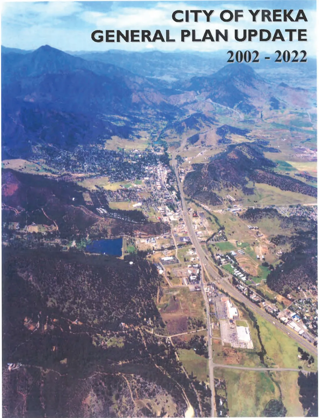
Section titled “i.1. Physical Description & Location”The City of Yreka is located in Siskiyou County in Northern California, and serves as the County seat. Located approximately 22 miles south of the California-Oregon border in the Shasta Valley, Yreka encompasses approximately 9.97 square miles and is situated along Interstate 5 (see Figure 01). The Bureau of Land Management (BLM) or private land surrounds the City with the Shasta Valley to the east and the Kilgore Hills to the southeast. The population of Siskiyou County is approximately 44,301, with 7,290 residents within the City of Yreka.
LEGAL BASIS & REQUIREMENTS OF THE GENERAL PLAN
Section titled “LEGAL BASIS & REQUIREMENTS OF THE GENERAL PLAN”California state law requires that every city and county adopt a general plan to guide physical development of the land within the jurisdictions’ boundaries. The plan acts as a “constitution” for the City and establishes guidelines for land use and development. Since the general plan affects current and future generations, state law requires that the plan take a “long-term” perspective. Typically, general plans look 10 to 20 years into the future. This plan addresses planning through the year 2022.
Figure i-1 - City of Yreka Locator Map
Section titled “Figure i-1 - City of Yreka Locator Map”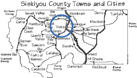
The law requires that the plan be comprehensive, and that specific subjects or “elements” be addressed in the plan. The required elements include [65302(a) through (g)]:
- land use
- circulation
- housing
- conservation
- open space
- noise
- safety
State law also allows the local jurisdiction to include additional, or “optional,” elements to address specific issues of concern, as well as combining the required and optional elements as deemed appropriate (65303). This General Plan combines the Open Space and Conservation elements into a single element and adds a Public Facilities Element (65301).
i.2. Requirements & Scope of the General Plan
Section titled “i.2. Requirements & Scope of the General Plan”In addition to addressing the mandatory planning topics, the General Plan must be:
Long Range: The general plan is intended to be long-range to avoid incremental planning decisions which may occur over many years and may eventually conflict with each other. This General Plan considers issues that may impact the City throughout the next two decades.
Comprehensive: The plan must coordinate all major components of the community’s development, covering the entire incorporated area of the city, as well as any other land that bears relation to the city’s planning. In addition, the plan must address the full range of issues associated with the city’s physical development.
General: Because it is long-range and comprehensive, the plan must be general in nature. The plan’s purpose is to serve as a broad framework for detailed public and private development proposals.
Internally Consistent: All parts of the plan (text, diagrams and figures in all elements) must be fully integrated and not conflict with each other.
i.3. Use of the General Plan
Section titled “i.3. Use of the General Plan”The City of Yreka General Plan is intended to serve as a tool to assist the City Council, Planning Commission, staff and other commissions or committees in formulating and implementing community guidelines and programs.
The General Plan has four main purposes:
- To enable the Planning Commission and City Council to reach agreement on long-range development policies.
- To provide a basis for judging whether specific private development proposals and public projects are in harmony with City policies.
- To allow other public agencies and private developers to design projects that are consistent with City policies, or to seek changes in those policies through the process of amending the General Plan.
- Provide an agreement among different agencies for development in unincorporated portions of the Planning Area.
i.4. Vertical Consistency
Section titled “i.4. Vertical Consistency”The General Plan provides the basis for all of the City’s regulations, policies and programs that relate to issues addressed in the plan. In addition to requiring that the plan be internally consistent, the State requires vertical consistency. This requirement means that the City’s zoning and subdivision ordinances, specific plans and redevelopment plans must all be consistent with the General Plan. In addition, all development approvals and public projects must be consistent with the General Plan.
The State’s General Plan Guidelines provide the following rule for defining consistency:
“An action, program or project is consistent with the general plan if, considering all its aspects, it will further the objectives and policies of the general plan and not obstruct their attainment.”
This rule clarifies that consistency does not require all subsequent City actions to be specifically anticipated by the general plan. Because the Plan is both broad and long-range, there are many circumstances where future City actions will be addressed only briefly in the Plan and refined by subsequent action.
Due to the complexity of the General Plan, and the need for flexibility, interpretations of the goals, objectives and programs may result in the appearance of conflicts. The City Council is the interpreter of the General Plan.
i.5. Background Report
Section titled “i.5. Background Report”A summary of existing conditions was prepared to help form the goals and programs of this General Plan. Published as a separate document, the background report provides a wealth of information on the City, its facilities and needs. The background report is also considered the existing conditions section of the General Plan Environmental Impact Report.
i.6. Special Studies
Section titled “i.6. Special Studies”The General Plan recommends preparation of special or subsequent studies necessary to fully implement the General Plan. Until adopted by the City, the City’s existing policies shall prevail.
i.7. Timing
Section titled “i.7. Timing”It is expected that the City may undertake the actions set forth within the General Plan at any time in the next twenty years. The City will undertake each program as it deems necessary, and provided both staff and financial resources exist to complete each program. Suggested timing is included in appropriate programs but may be modified to meet resources and ability of the City.
i.8. Consistency Between The General Plan & Zoning Code
Section titled “i.8. Consistency Between The General Plan & Zoning Code”The Zoning Ordinance is an important tool for implementing the General Plan. Requirements for consistency between the General Plan and zoning can be broken down into three aspects:
USES AND STANDARDS
Section titled “USES AND STANDARDS”The general plan’s land use classifications are not as specific as zoning ordinance classifications. For example, the General Plan has three different categories for residential use, while the zoning ordinance is likely to have more. Multiple zoning districts may be consistent with a single general plan designation, as long as the densities and unit types allowed in each zoning district are also permitted in the relevant general plan designation.
SPATIAL CORRELATION
Section titled “SPATIAL CORRELATION”The Zoning Map should reflect the general pattern of land use depicted on the Land Use Diagram. However, the two need not be identical. Boundaries of land use classifications depicted on the Land Use Diagram are generalized; zoning boundaries may be more precise and parcel specific.
General Plan designations need not have immediate consistency with zoning.
TIMING
Section titled “TIMING”State law allows a “reasonable time” for reconciling any inconsistencies between the Zoning Ordinance and the general plan. The City anticipates that all zoning and general plan inconsistencies will be addressed within the five (5) years following adoption of the General Plan.
i.9. General Plan Elements
Section titled “i.9. General Plan Elements”Each General Plan element contains: a brief discussion of the legal requirements; goals, objectives, policies and implementation programs to address required topics; and, narrative text as necessary to provide understanding of the issues addressed. The following terms apply within this General Plan:
GOAL:
An achievement toward which an effort is directed. The Goal states an ideal resolution of the issue under consideration.OBJECTIVE:
A specific statement in the form of text or diagram that helps clarify and define the goal statement.PROGRAM:
Programs are specific actions that are readily quantifiable and help move toward attainment of the goal.
Each goal is numbered to allow easy reference when using the General Plan. The numbering system does not imply a ranking or priority of the goal(s) and program(s).
While the topics that must be addressed within the general plan are clearly specified by State law, the organization of discussions is determined by each jurisdiction based upon the particular local conditions and issues of significance.
Following are descriptions of the sections of the Yreka General Plan and discussions of the topics, which are addressed within each section. In total, these sections address the most significant issues facing the City of Yreka and satisfy the legal requirements of the general plan as defined by state law.
INTRODUCTION
Section titled “INTRODUCTION”This introduction provides a brief overview of the City of Yreka and its physical setting. The requirements and structure of General Plans are reviewed and a description of the format of this General Plan is provided.
LAND USE
Section titled “LAND USE”The Land Use element provides guidance for the physical form of the community. A land use diagram identifies the existing and proposed land uses within the City. The land use diagram is supported by descriptions of allowed uses and development densities for each land use designation. Additionally, the land use diagram identifies those areas where the City anticipates growth in the future, with the intent of avoiding incompatible land use changes by neighboring agencies and jurisdictions.
CIRCULATION
Section titled “CIRCULATION”The Circulation element provides a framework to guide transportation planning throughout the City and its planning area. The Circulation Element is coordinated and consistent with portions of the Land Use, Community Design Enhancement, Public Services and Facilities, and Safety Elements, which address topics directly related to circulation and transportation. Discussion topics include roadway network, road improvement standards guidelines, road maintenance, pedestrian and bicycle circulation, railroad, and public transit.
HOUSING
Section titled “HOUSING”The Housing element is presently being revised to coincide with release of detailed economic information from the 2000 census and the statutory requirement to update the General Plan by June 30, 2003. [Govt. Cd. §65588(e)(5)] This Housing element is presently being reviewed by the California Department of Housing and Community Development.
OPEN SPACE & CONSERVATION
Section titled “OPEN SPACE & CONSERVATION”Typically a broad ranging element, many Open Space and Conservation topics are addressed within other sections of the General Plan. This section addresses managed resource production (agriculture and mineral extraction), biological resources, air quality and water resources. A description of natural resources within the vicinity of the City is provided.
The Noise element was prepared in 1998 and adopted by the City. The element was not revised as part of this general plan update.
PUBLIC HEALTH AND SAFETY
Section titled “PUBLIC HEALTH AND SAFETY”Issues discussed within the Public Health and Safety element include emergency preparedness, flood hazard, fire and police protection, geologic hazards, hazardous materials and waste management, and rail service related hazards.
PUBLIC FACILITIES
Section titled “PUBLIC FACILITIES”This element describes public services within the planning area.
i.10. General Plan Implementation
Section titled “i.10. General Plan Implementation”The City of Yreka must meet a broad range of challenges and obligations with limited financial resources. Many of the programs described within this General Plan address situations that have evolved over a number of years and will not be easily resolved.
Since financial limitations are the primary constraint in addressing many of the issues that face the City, it is imperative that the City seek economically feasible strategies for implementing General Plan programs. Such strategies will include seeking funding assistance through state and federal grant programs. Some issues will be more easily resolved by working in conjunction with other local agencies to achieve mutual goals.
i.11. General Plan Amendments
Section titled “i.11. General Plan Amendments”State law provides for up to four amendments to the general plan each year. An amendment may include several “changes” to the general plan. The City of Yreka may process general plan amendments every four (4) months, and may keep in reserve one (1) amendment to be used in case of a special project or need. Amendments to the General Plan require compliance with the Government Code and environmental laws before they can proceed.